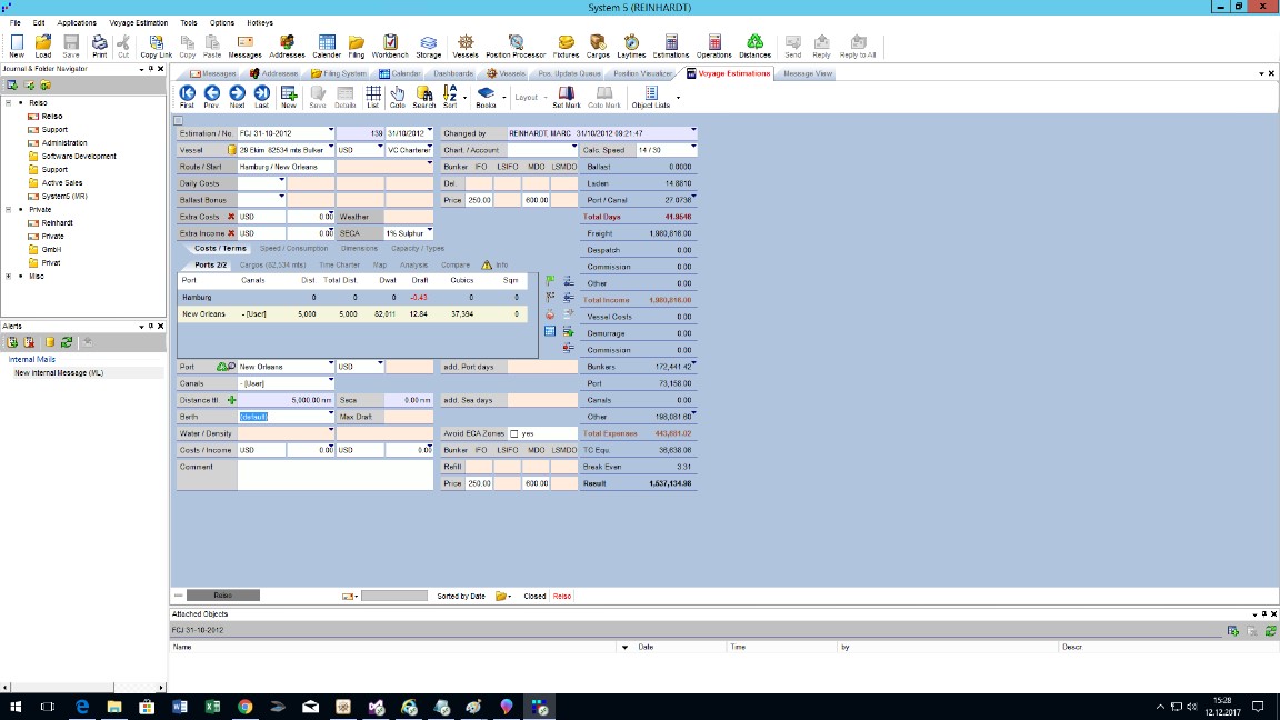
“T/C-Voyage Estimations” including “Distance Table” represents an easy-to-use, yet powerful tool for your calculations. Results for different speeds, T/C equivalents, break-even rates are just a mouse-click away. The option to save port, berth and canal details including costs, as well as cargoes including stowage factors in relevant databases complete the calculator. It goes without saying that virtually unlimited combinations of load-, discharge-, and bunkering ports, as well as part cargoes may be calculated. Comparisons between different voyage options or different vessels for a cargo are done within no time. The integration with other System 5 modules is, of course, standard.
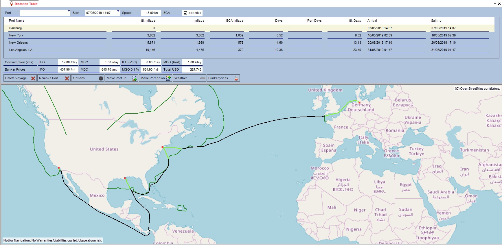
Our new “Distance Table” covers over 2,300 ports around the globe. Missing ports can be implemented on request within short time. For users switching from our formerly used (third party) distance table to our new engine, we implemented a port mapping table. That allows an automatic conversion of most of the voyage calculations.
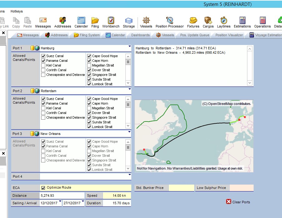
The new engine includes the calculation of distances within ECA zones. It optimizes the entry point into an ECA Zone, depending on bunker prices (low sulphur vs. standard grade). Routing directives like canal usage (Suez, Panama, Kiel) and certain passing points (Cape Good Hope, Cape Horn, etc.) can be applied. Routes are displayed on a high resolution map using “OpenStreetMap”.